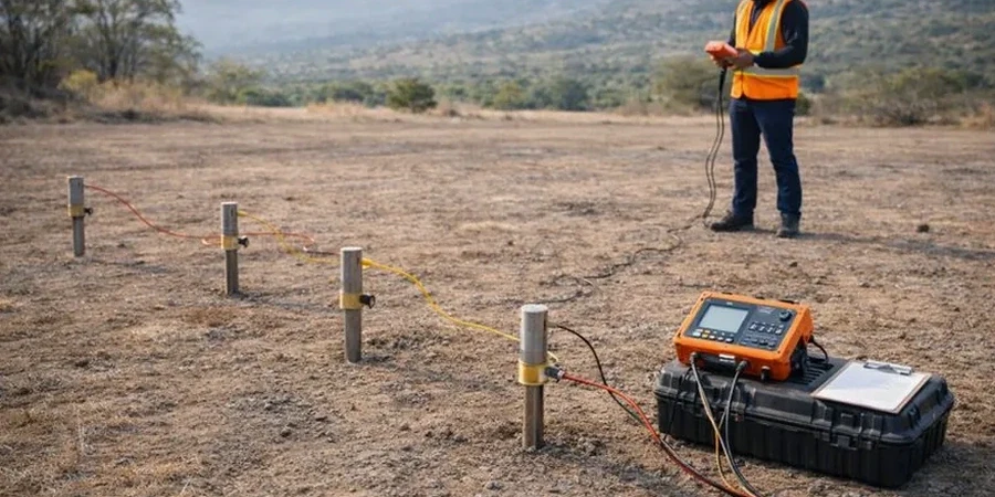
The ABEM Terrameter LS2 is the workhorse for deep resistivity sounding in Surrey. Four stainless steel electrodes push into the ground at expanding spacings—starting tight, then reaching out to 200 metres. The current flows. The potential drops. The resistivity stack builds. Surrey's geology is a puzzle of silty clays, peat lenses, and coarse glacial till. Direct push rigs get refused on cobbles. But an electrical sounding reads right through it. In Newton or South Surrey, we run Schlumberger arrays to map the salt wedge in the Semiahmoo aquifer. In Cloverdale, we target gravel channel boundaries for aggregate resource estimates. The data tells you what's below without turning a single shovelful of Surrey soil.
Resistivity contrasts map the contact between compressible Fraser River silts and competent Pleistocene till—a boundary that defines foundation costs in Surrey.